The Day Rhys Ran Off on Cerro San Luis Obispo
What 30 minutes of searching in the fog taught us about dog tracking, and why cell-based trackers fail exactly when you need them the most
As an Amazon Associate, we earn from qualifying purchases.
The Summit Incident
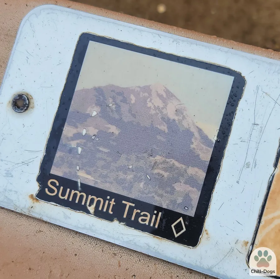
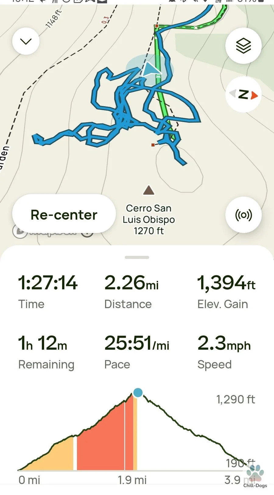
We had done the Cerro San Luis Obispo hike a dozen times. It's a popular trail outside San Luis Obispo — rocky, a solid 45-minute climb, with a clear view from the summit on good days. That morning was not a good day for visibility.
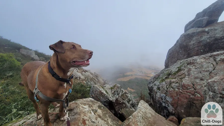
I was hiking with my 7-year-old dog Rhys and Astro, my friend's two-year-old shepherd mix. We made the summit around 8 a.m. Fog had rolled in overnight and hadn't burned off. The summit was a gray-white wall in every direction.
We stopped to give the dogs water. I set my pack down and reached for a bowl. That's when it happened.
Rhys saw something in the fog. We never figured out what — a deer, a ground squirrel, a shadow. He lunged hard to the right. The leash — held loosely in my hand while I dug out a water bottle — pulled free.
Rhys was gone in four seconds. Into the fog, off the summit rocks, direction unknown.
The 30-Minute Search
I started searching across the broad foggy mountain top. Fifteen minutes in, I found his collar and harness — somehow pulled off, hanging on a tree.
I called Astro to heel and went down the east side of the ridge calling Rhys's name. Fog made sound direction unreliable. I whistled. I waited. Nothing.
Twenty minutes later, I heard a distant bark in response to my call. I moved towards it and kept calling — he wasn't moving anymore. This was making me very nervous, but also very hopeful I would find him soon. When I found him, he was trapped in a tree-well, with a steep boulder field behind him and tree branches poking from all sides preventing him from getting out the way he got in. I managed to pull him out and get him calmed down. We were both quite relieved the ordeal was over, and I resolved to get a GPS tracker on him.
Rhys wasn't wearing a GPS tracker that day. That's the whole point. After finding him trapped in that tree-well, I went home and bought one.
Key point
Cell-based GPS trackers like Fi and Whistle are reliable everyday tools. They are not reliable in remote, rural, or no-signal environments. If you regularly hike in wilderness areas, cell coverage maps should be part of your gear planning. For true off-grid use, you need an entirely different system.
Four Things We Learned That Day on Cerro San Luis Obispo
Four practical things that came out of the Cerro San Luis Obispo incident.
- Check cell coverage before the trailhead, not at the summit. Cell signal often drops well before you reach the most remote parts of a hike. On Cerro San Luis Obispo, coverage was gone before the last half mile. A tracker that relies on LTE is a city tool, not a backcountry tool.
- Know which direction wildlife is likely to come from. Rhys ran into the fog because something triggered his prey drive in that direction. On exposed summits and rocky terrain, keeping the leash in an active grip — not a loose hold — is worth the extra attention.
- Off-grid tracking is a different category of gear, not an upgrade. Garmin's off-grid systems aren't "better" than Fi. They solve a different problem — tracking without cell signal — and come with real trade-offs (cost, bulk, handheld device required). Know which problem you are addressing.
Tracker Types Explained
Three categories solve different problems. Knowing the difference matters more than knowing the brand names.
Fi, Whistle, and similar
Uses the LTE cellular network to report real-time location to your phone. Works in cities, suburbs, parks, and anywhere with cell coverage. Updates are near-instant. Easy to use.
Works well: Cities, suburbs, parks, campgrounds with coverage
Fails: Remote trails, wilderness areas, mountains without cell signal
Garmin Alpha, T&REx
Uses GPS satellites and VHF radio — no cell network required. A dedicated handheld device shows your dog's location. Range up to 9 miles line-of-sight. No monthly subscription.
Works well: Wilderness, backcountry, hunting terrain, anywhere with sky view
Trade-offs: High upfront cost, bulkier collar, requires a separate handheld device
AirTag, Tile
Not GPS tracking. Updates location only when another device in the network passes nearby. Affordable and passive. Useful as a supplemental backup layer in cities, not as a primary tracker.
Works: Dense cities as a supplemental backup
Fails: Remote areas, anywhere sparse. Not a real-time tracker.
| Scenario | Best tracker type | Why |
|---|---|---|
| City dog, daily walks and parks | Cellular (Fi, Whistle) | LTE coverage is reliable; easy app interface |
| Suburban dog who occasionally hikes | Cellular + check coverage maps | Fine for most trails; know before you go |
| Hiking into remote or wilderness terrain | Off-grid Garmin system | Only option that works without cell signal |
| Hunting or field dog work | Off-grid Garmin system | Range, ruggedness, and multi-dog tracking |
| Budget backup for city dog | Bluetooth tag (AirTag) | Low cost, passive — understand limitations first |
Which Tracker to Choose
Quick links to each category and what to read first.
Everyday + city use
Fi Series 3 is the well-regarded option here: slim collar, real-time LTE, escape alerts, geofencing, activity data. Subscription required.
Read the Fi Collar review →Hiking + wilderness
Garmin's off-grid systems are the only trackers designed for no-signal terrain. GPS + radio, up to 9-mile range, no monthly fee.
See Garmin dog tracking systems →Budget backup layer
AirTag or Tile can supplement a collar setup at low cost. Not real GPS — understand exactly what they are and aren't before relying on them.
AirTag for dogs: honest assessment →Full comparison
See all three tracker categories side by side — cellular, off-grid, and Bluetooth — with honest trade-offs for each.
See the full GPS tracker comparison →GPS Tracker FAQ
- Do GPS dog trackers work on hiking trails?
- It depends on the type. Cellular GPS trackers like Fi require LTE signal and will fail in remote or no-service areas. Garmin off-grid systems use GPS satellites and VHF radio. They work anywhere you can see the sky, including deep wilderness. Know your terrain before you hike.
- Will an AirTag help me find my dog in the mountains?
- Unlikely. AirTags use crowd-sourced Bluetooth through the Apple Find My network. If your dog runs far away from anyone with an Apple device, the tag will not update. They work reasonably well in cities but are not reliable in remote terrain.
- What is the best GPS tracker for hiking with dogs?
- For true hiking and wilderness use, Garmin off-grid systems (Alpha 300, T&REx) are the reliable choice. They use GPS and radio with no cell dependency. For moderate trails near civilization, a cellular tracker like Fi is more convenient but depends on cellular coverage.
- How far can a dog run before a tracker stops working?
- Cellular trackers stop updating the moment your dog leaves cell coverage — distance does not matter. Garmin off-grid systems have a line-of-sight range of up to 9 miles. AirTags update only when another Apple device passes nearby, which in remote areas could be never.
- Should I use a GPS tracker even if my dog is leashed?
- If you hike in areas with wildlife, a tracker is worth considering even for leashed dogs. Leashes can be dropped or break, and it only takes a second. A tracker gives you a head start if the worst happens.
- Can I use a Fi collar off-grid?
- No. Fi uses LTE cellular tracking. Without cell signal — on remote trails, in canyons, or in wilderness areas — the collar cannot report a location. If you regularly hike off-grid, pair Fi with a Garmin system or switch to a Garmin for those trips.
Know Your Options Before the Trail
The best tracker for a city walk is not the best tracker for a wilderness hike.